
Today’s low altitude photogrammetric surveying transcends technologies originally developed for data processing high altitude stereopair imagery. This type of surveying generated models with less accuracy than what is achievable today using a low altitude UAV.
In the past high altitude aerial surveying still relied on Ground Control Points (GCP). However, commonly this included utilising a range of both man-made and naturally occurring objects which people considered visible, such as common objects like fence posts, power poles, manhole covers, roadway line markings, corners of buildings, concrete blocks and trees or stumps.
It is important to recognise that random structures which may be clearly identifiable on the ground may not always be distinguishable when captured in imagery taken at a higher altitude, particularly when grouped with similar objects. Today, we should also recognise that the increased accuracy that low altitude aerial surveying provides requires abandoning the use of such features.
Using random objects often results in the inability to clearly select the coordinate reference location with the same accuracy that is deliverable from using purpose built GCP.
Examples of poor object selection for GCP include:
the use of power poles
Limits the precision in picking the reference location at best to around 10 cm (the diameter of the pole itself). The objects girth also fails to provide an identifiable point, given its typical cylindrical shape.

These types of objects only show one side of the structure in any image, which may not always depict the true reference position. Recognise that low altitude UAV rely on picking the GCP location in far more images than higher altitude surveys. As such the delta error in defining the reference location from different photos becomes significant.
Furthermore, if you have vegetation growing around the base of a pole structure this can also obscure the view of the actual reference point at its measured ground level.
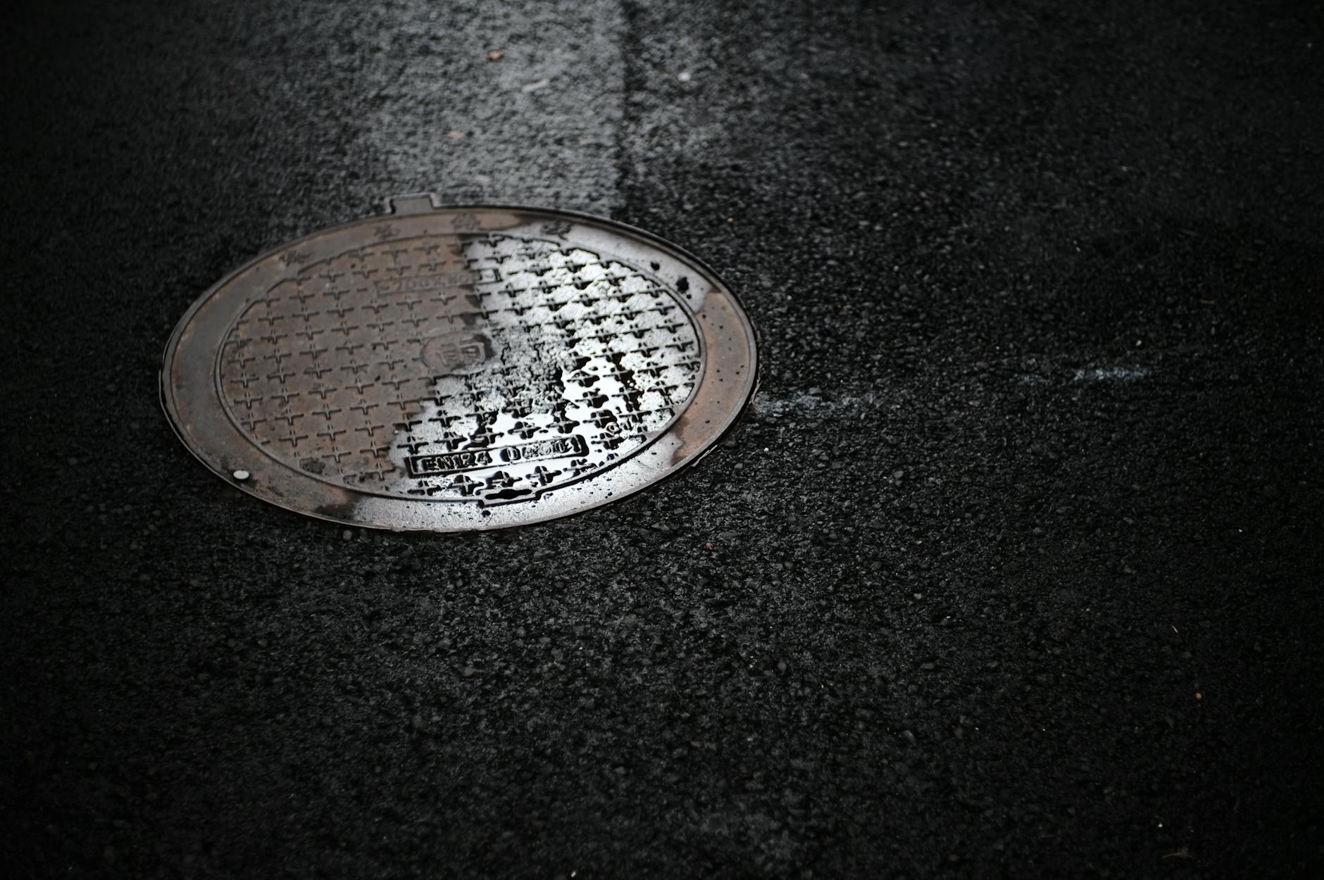
manhole covers
Although these structures may be considered usable, they have potential to result in errors. Recognise that the cover plate is a removable object and as such can be moved and then replaced, resulting in any reference marks made on the surface being out of alignment when the structure is returned to position.
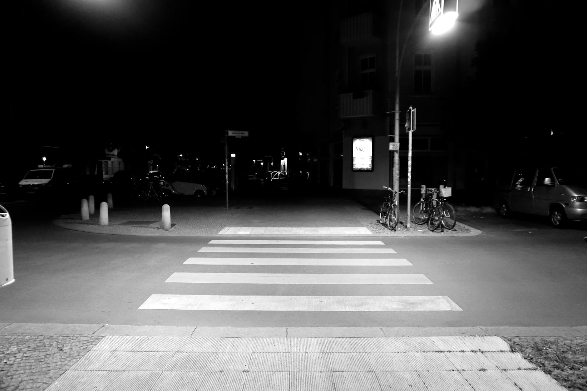
roadway lines
General traffic management line work on roadways looks repetitive, and as such it can be confusing when attempting to select an unambiguous reference position. Furthermore, it can be changed at a moment’s notice by third parties carrying out road maintenance.
Poor choice of features utilised for reference locations, or bad design of dedicated GCP will result in rework or having to accept inferior results. The ability to achieve centimetre accuracy for a reference location requires identifying a point no larger than an individual pixel within an image.
The form of the GCP is to simply provide a view which enables the reference position to be identified in imagery and selected with both accuracy and precision on a repeatable basis. Ideally GCP should be distinguishable from all other objects.
Install purpose built GCP, rather than relying on natural or common man-made features.


Leave a comment